Cities like New York have implemented varied supermarket incentive programs, from low-cost financing to zoning bonuses, to increase access to healthy food and reduce diet-related chronic diseases in underserved communities. The impacts of these programs are often hard to measure due to a lack of accurate, reliable data on current food retailers and historical data on food environments.
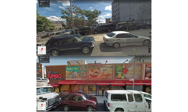
In a study published recently in the journal Health and Place, a research team led by CUNY SPH Associate Professor Nevin Cohen used Google Street View (GSV) to verify the status of food retailers listed in a New York State database of licensed establishments in the Bronx from 2008 and 2017.
GSV images enabled the researchers to identify discrepancies in the state database and to measure store openings and closings over the decade, as well as changes in store brands and types. An analysis of food retailers throughout the Bronx revealed several trends likely to affect food access and health: increasing overall numbers of food outlets; the growth of dollar stores (a retail segment specializing in processed, shelf-stable food); and numerous openings, closings, and ownership changes across all food retail segments. Hot spot analysis identified statistically significant clusters of new dollar stores and bodegas in lower-income neighborhoods in the South Bronx that face elevated rates of diet-related diseases.
Source: Read Full Article